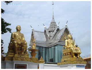
Uthai Thani Province, Former residence of prehistoric man and is home to many ancient cities in Dvaravati. Originally named the city "Uo Thai". Following drought because currents change direction, the city was abandoned. Later, in Ayutthaya, with Karen a "Patabiad" to improve the city by digging Thai Garage submerged into the lake near the town and a city government. Karen a lot, since people are making changes to a city called "Uthai" city. The accent Karen And has become the location of the town Uthai Thani today. Uthai Thani is the Lower North. The area of 6,730.246 square kilometers, population 327,871 people, most forested areas and high mountains. Forests of the province has abundant and diverse natural cause is a sanctuary Huai Kha Kaeng and has been registered as world heritage site worthy of care, and bring pride to the Thai people. .
Uthai Thani Province, a place of interest, history, archeology, nature and many interesting and learn. There are also products that are believed acoustic handicraft, textiles, basketry A march to nearby provinces as follows.
North - Nakhon Sawan.South - Suphan Buri and Chai Nat province.
East - Changwat Chai Nat and Nakhon Sawan. (Chao Phraya River is the boundary line).
West - Tak and Kanchanaburi.
And divided the area into 8 districts.and 70 subdistricts , 642 villages.
1.Mueang Uthai Thani
2.Huai Khot
3.Nong Khayang
4.Ban Rai
5.Thap Than
6.Sawang Arom
7.Nong Chang
8.Lan Sak
Provincial tree : Azadirachta indica v. siamensis.
Provincial flower : Cochlospermum regium.
Getting to Uthai Thani
Car.
- From Phaholyothin Road, through Saraburi, Lop Buri, Nakhon Sawan and, Chainat Province. Across the river to ferry (A Manorom) via Wat Tha Sung. (Measured Chantharam), City Hall, Uthai Thani province to the market. . (A total distance of approximately 305 km).
- From Highway 32 through Ayutthaya - Ang thong - Sing Buri - Chai, then turn left at the fork position molasses milestone No. 206, then across the bridge over the river along Highway 333 road, 16 km turn left in front of the hospital. Uthai Thani to the market. Total distance is about 222 km
- From Highway 32 through Ayutthaya and Turn left across the bridge at Ang Thong Province. Drive through the streets in Sing Buri Province. Chao Phraya Dam. Sing District - Wat Tha Sung - city hall Uthai Thani province to the market. (Approx 283 km).
Bus.
- The Transport Company Limited bus service. Bangkok - Uthai Thani every day from the Northern Bus Terminal. (Road, Kamphaeng Phet 2) Approximately 4 hours from the time 04.30am-17.50pm. For more information call. 936-1972, 936-1882, (056) 511914,512859.
Train.
- Need to train down at the train station, Nakhon Sawan, then travel to the bus. To go to Uthai Thani province, about 50 km. more contact Tel. 223-7010, 223-7020.


ไม่มีความคิดเห็น:
แสดงความคิดเห็น